Falmouth Maps and Orientation
(Falmouth, Cornwall, England, UK)
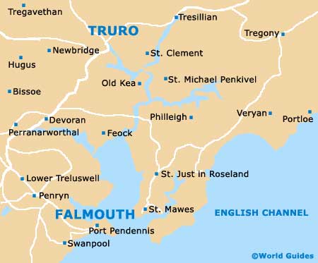
Standing directly east of the huge Carrick Roads waterway, Falmouth is known around the world for its vast natural harbour, which is extremely deep. Falmouth is a busy seaport and centred around the River Fal, on Cornwall's attractive southerly coast. Part of the Carrick district, Falmouth lies directly opposite St. Mawes and is linked by a series of year-round ferries.
Maps and Orientation of the Town
Although Falmouth's maritime industry is no longer at its peak, the docklands here continue to be an important part of the town's overall economy. Many large cruise ships dock here during the course of the year and around the port are a range of popular waterfront attractions.
Many people visiting Falmouth enjoy the beaches and in total, this area is home to five main beach areas, the beaches of Castle Gyllyngvase, Maenporth, Swanpool and also Tunnel. These beaches are all close to the historic Pendennis Castle and stretch towards the meandering Helford River.
Close to the A39 and the A394, the main roads within Falmouth include the Castle Drive, Cliff Road, Dracaena Avenue, Melvill Road, Spemen Wyn Road and Western Terrace. The following locations are particularly close to Falmouth and are shown complete with relevant directions and distances in both kilometres and miles.
- Bissom - 3 km / 2 miles (6 minutes, north-west)
- Budock Water - 3 km / 2 miles (6 minutes, west)
- Feock - 14 km / 9 miles (18 minutes, north-east)
- Flushing - 6 km / 4 miles (18 minutes, north)
- Kergilliack - 2 km / 1 mile (3 minutes, west)
- Maenporth - 5 km / 3 miles (8 minutes, south)
- Mylor Bridge - 6 km / 4 miles (9 minutes, north)
- Newquay - 37 km / 23 miles (40 minutes, north)
- Penryn - 3 km / 2 miles (6 minutes, north-west)
- Port Pendennis - 2 km / 1 miles (4 minutes, east)
- Redruth - 16 km / 10 miles (22 minutes, north-west)
- Roskrow - 6 km / 4 miles (8 minutes, north-west)
- St. Erme - 24 km / 15 miles (26 minutes, north)
- Swanpool - 2 km / 1 mile (4 minutes, south)
- Truro - 18 km / 11 miles (18 minutes, north)
Map of the United Kingdom

Map of Cornwall

Map of Falmouth